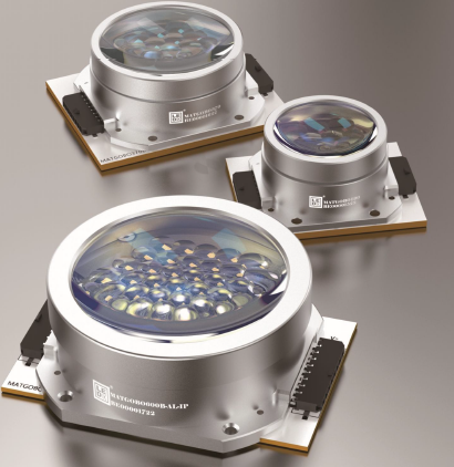
The Geomative GD-22 is a resistivity and induced polarization imaging system for investigating subsurface electrical contrasts. For mineral exploration teams, it can contribute to identifying and prioritizing targets where geology and physical properties support the use of electrical methods.
Its role is to acquire measurements that inform interpretation. Establishing mineralization, ore-body boundaries, or an economic resource requires geological evidence and appropriate follow-up verification.
Product Positioning and Core Design
The GD-22 belongs to Geomative’s GD resistivity and IP range. It provides six receiving channels and supports field acquisition for electrical investigations.
For deep mineral exploration, the proposed configuration should match the expected target response, survey geometry, access conditions, and acquisition schedule. Relevant questions include whether the measurements will have sufficient signal quality and whether the survey can distinguish the target from other geological features.
Technical Highlights
The current GD-22 specification table lists:
| Parameter | Published specification |
|---|---|
| Receiving channels | 6 |
| Maximum transmit power | 15 kW |
| Maximum transmit voltage | 1,500 V |
| Maximum transmit current | 10 A |
| A/D conversion | 24-bit |
| Power-line rejection | ≥120 dB, selectable 50/60 Hz |
| Full-waveform acquisition | Supported |
These are instrument specifications. Actual operation depends on the power supply, electrical load, cables, switching equipment, and selected measurement mode.
Power-line rejection describes a specific interference characteristic. It does not guarantee performance against every noise source, and A/D resolution alone does not establish field accuracy.
Practical Value for Deep Mineral Deposit Localization
Three aspects deserve attention when evaluating GD-22 for a deep-target survey.
Transmitter capacity. Available voltage and current can help establish usable measurements under suitable conditions. Achievable depth also depends on target contrast and dimensions, survey layout, overburden, and noise.
Field quality review. Inspecting observations and available waveforms can help crews investigate questionable measurements before moving on. Repeat observations remain necessary for checking consistency. Roll-along acquisition serves a separate purpose by extending survey coverage.
Deployment configuration. Surface, tunnel, borehole, and water-based investigations require appropriate layouts and accessories. Buyers should confirm the complete configuration for each intended environment.
A representative test line provides a practical way to assess these capabilities together.
Industry Adaptation Beyond Mineral Exploration
Related electrical survey applications include groundwater investigation, engineering studies, seepage assessment, environmental investigation, and archaeology.
Each application requires its own design and interpretation criteria. A low-resistivity anomaly, for example, may have several possible causes and does not independently confirm groundwater, contamination, or leakage.
Long-term monitoring also requires defined acquisition schedules, maintenance, data review, and verification procedures. These functions should be specified separately from a one-time survey configuration.
Field References and Their Limits
Geomative’s published Brazil gold exploration case describes resistivity and IP work using a GD-10 instrument. It provides a reference for investigating potential mineralization targets, rather than direct evidence of GD-22 performance.
The Beishan lead-zinc mine case concerns GT-30 transient electromagnetic work. Geomative reports subsequent exposure verification of interpreted targets in that project. The result remains specific to the method, equipment, and conditions described.
Neither case establishes what a GD-22 survey will achieve at another site. Buyers should request references with comparable geology and survey objectives, together with available raw data and follow-up evidence.
Who Benefits Most From This Technology
GD-22 merits consideration for teams whose investigation requires resistivity and IP measurements and can make practical use of its receiving capacity.
Suitability should be established through expected physical-property contrasts, a workable field layout, and an interpretation plan. A project seeking a deep conductive or polarizable target may have different requirements from one mapping shallow resistivity structure.
The purchasing decision should also account for staffing, transport, power, training, and access to technical support.
Integration With the Broader Data Workflow
DIGspace provides a spatial data environment with desktop analysis and web collaboration capabilities. Its ERT workflow can support data review, inversion, and presentation of results.
Before purchase, confirm the software modules available for the proposed GD-22 configuration. Distinguish resistivity processing, IP processing, three-dimensional visualization, and three-dimensional inversion rather than treating them as one function.
Test representative files through the complete workflow. Check that electrode positions, units, acquisition settings, and quality information are preserved, and confirm access to original observations and exported models.
For remote projects, establish connectivity requirements and offline arrangements. Processing parameters and software versions should remain traceable so results can be reviewed or reproduced.
Summary
The GD-22 offers a six-channel resistivity and IP configuration with published transmitter ratings up to 15 kW. Its value for deep mineral exploration depends on the complete survey configuration and the ability to obtain interpretable measurements at the site.
Request a project-specific quotation and a representative acquisition and processing demonstration. Assess measurement repeatability, practical coverage, software functions, and support alongside the specifications.
The resulting interpretation can guide further exploration, with drilling, sampling, or other appropriate evidence used to establish the geological significance of the targets.
https://www.geomative.com/
Geomative Co., Ltd.
About Author