Understanding Embankment Seepage and Internal-Erosion Risks
Embankment seepage and internal erosion can develop below the surface and may be influenced by water level, rainfall, material condition, foundation geology, and existing drainage arrangements. Their assessment requires more than a single measurement or periodic inspection.
Geophysical surveys can provide information about subsurface electrical variations that may warrant further investigation. Online monitoring can provide a continuous time series after suitable field deployment. However, neither approach independently confirms piping, predicts dam failure, or replaces routine inspection, direct verification, maintenance, and qualified engineering assessment.
Geomative Co., Ltd., headquartered in Shenzhen, China, provides geophysical equipment and online monitoring solutions under its “Geophysics+” concept, combining field hardware, IoT connectivity, and cloud-based data services.
From Periodic Checks to Continuous Data Observation
Periodic inspections and targeted investigations remain important components of embankment safety management. For projects that require long-term observation, a connected monitoring workflow can supplement these activities by collecting and transmitting data between site visits.
According to Geomative’s current product information, the DIGspace Geo-3D Platform is the company’s latest product naming for its developing digital-platform offering. The company’s public online monitoring information describes a system that combines field monitoring equipment, cloud data transmission, IoT communication, and data-analysis functions.
When deployed with a project-specific design, the system can support:
-
24-hour online data collection and remote data access;
-
configured thresholds, alert levels, and notification methods;
-
trend review, data display, modelling, and collaboration;
-
integration of manual inspection, periodic survey, and real-time monitoring data.
For dam and embankment projects, long-term resistivity monitoring may help teams observe changes associated with moisture conditions, water-level variation, or possible seepage-related anomalies. Any abnormal pattern should be reviewed together with site conditions, inspection records, geological information, and engineering analysis.
Electrical Resistivity Surveys for Embankment Investigation
Electrical resistivity tomography (ERT) and induced polarization (IP) surveys can help project teams investigate subsurface electrical contrasts. In embankment and foundation investigations, these contrasts may be associated with changes in water content, material composition, fractures, weak zones, backfill, or other geological conditions.
Such results are indirect geophysical evidence. They should be correlated with boreholes, design information, construction records, hydrogeological data, and field observations before a seepage pathway or internal-erosion mechanism is concluded.
GD-10 Single-Channel Electrical Resistivity System
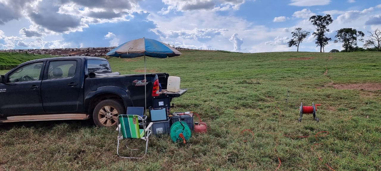
The GD-10 is a single-channel electrical resistivity system. Depending on model and configuration, it can support 1D vertical electrical sounding and 2D ERT/IP profiling, with applicable configurations for 3D survey work.
For targeted embankment, dam-foundation, or surrounding-ground investigations, GD-10 can provide electrical data to support integrated interpretation. Survey design should be determined by the target depth, geological conditions, access constraints, electrode layout, and the engineering question being assessed.
GD-20 Multichannel Electrical Resistivity System
The GD-20 is a multichannel electrical resistivity system with an independent 5/12-channel design. In ERT surveys, it can acquire up to 10 channels of data simultaneously. In VES work, it can test up to 12 sets of sounding points at the same time.
Geomative states that, under comparable conditions, the GD-20’s multichannel average test efficiency can be 2–3 times that of single-channel equipment. The system supports resistivity, IP, and self-potential measurement, with 2D, 3D, and pseudo-3D survey options depending on configuration and survey layout.
Its public product information lists dam seepage and leakage detection among its application directions. For embankment projects requiring multiple survey lines or broader coverage, project teams can assess GD-20 according to field conditions and investigation objectives.
Data Preparation and Field Workflow
Geomative Studio supports array-script management and survey-parameter preparation for electrical resistivity work before field deployment. This can help teams organize survey layouts and acquisition settings within the equipment workflow.
Data quality, interpretation confidence, and the suitability of any monitoring layout remain dependent on site conditions, electrode contact, noise, survey geometry, environmental variation, and the technical experience of the project team. Geophysical data should therefore be subject to quality review and interpreted in context.
Power Supply Selection for Field Surveys
Electrical resistivity and IP surveys require a power configuration suited to the project’s survey method, transmission requirements, line length, safety conditions, and site access.
Geomative provides geophysical power products including BP-150, BP-300, BP-450, BP-250, and GP-5000. These products have different output, power, portability, and application characteristics. BP-250 is a DC power-supply booster, while GP-5000 is a high-power rectifier intended for compatible high-power DC requirements.
Power selection should be based on the actual survey configuration. A higher-power unit does not by itself guarantee greater investigation depth, improved data quality, or a confirmed seepage result.
Related Evidence From Subsurface Investigation
Geomative documents a chemical-factory oil-pollution investigation in which a Wenner-Schlumberger ERT survey was used to investigate subsurface electrical anomalies. The case reported a pollution-distribution area of approximately 1,287 m², with anomaly depths averaging about 3–7m and reaching approximately 12m.
This environmental case demonstrates the use of ERT for mapping subsurface electrical conditions in a specific pollution-investigation setting. It should not be presented as direct evidence of a dam-piping or embankment-seepage result, because contaminant properties, site geology, target conditions, and verification methods differ between projects.
Building a Practical Monitoring Workflow
A robust embankment monitoring workflow may include:
-
Baseline investigation — review design records, geological and hydrogeological information, inspection history, and carry out appropriate direct and geophysical investigation.
-
Project-specific system design — determine monitoring sections, electrodes or sensors, data intervals, communications, alert thresholds, maintenance responsibilities, and verification procedures.
-
Continuous observation — collect and transmit monitoring data for remote review and trend comparison.
-
Engineering review and response — investigate abnormal data with field inspections, direct verification, and qualified engineering analysis before mitigation or repair decisions are made.
Conclusion
Embankment seepage monitoring is a continuing risk-management process, not a single-instrument task. Electrical resistivity surveys can support baseline investigation and anomaly review; online monitoring can supplement this work with continuous data collection and remote observation.
Geomative’s GD-10 and GD-20 electrical resistivity systems, geophysical power products, and DIGspace Geo-3D Platform provide equipment and digital-platform options that dam operators, water-conservancy organizations, and engineering teams can evaluate for connected monitoring workflows. Final system design and safety decisions should always be based on project-specific conditions and qualified engineering assessment.
https://www.geomative.com
Geomative Co., Ltd.
About Author